Tyler McClelland leads mitigation operations for Advanced DRI across New York's Hudson Valley, directing water, mold, and large-loss response in the field. He holds IICRC Water Restoration Technician (WRT) and Applied Microbial Remediation Technician (AMRT) certifications and a New York State Mold Supervisor certification, and is trained in IRCA hospital safe construction practices recognized by The Joint Commission.

Hartford CT faces dual threats from Connecticut River flooding and aging building infrastructure. Local data on flood zones and building vulnerability.
Hartford's Dual Challenge
Hartford, the capital of Connecticut and the heart of the Greater Hartford metropolitan area, faces two converging property risk factors that together create challenges greater than either would present alone. The first is the city's exposure to flooding from the Connecticut River and its tributaries. The second is the age and condition of its building stock, much of which was constructed before modern building codes and flood-resistant design standards existed.
At Advanced DRI, we provide water damage restoration services across the Hartford area. Our teams understand how these two factors interact to create property damage scenarios that require specialized knowledge and local expertise to resolve properly.
Hartford Neighborhood Flood and Building Risk Matrix
| Neighborhood | % Pre-1960 Buildings | Flood Exposure | Combined Risk | Primary Damage Type |
|---|---|---|---|---|
| Sheldon / Charter Oak | 85% | High (CT River) | Very High | Flood + structural |
| Frog Hollow | 88% | Moderate (stormwater) | High | Plumbing + basement |
| Barry Square | 82% | Moderate (stormwater) | High | Water intrusion + mold |
| North End / Upper Albany | 78% | Moderate (Park River) | High | Basement flooding |
| South End | 72% | Moderate-High | Moderate-High | Drainage + aging |
| West End | 80% | Low | Moderate | Plumbing + roof aging |
| Asylum Hill | 75% | Low | Moderate | Infrastructure aging |
Sources: U.S. Census Bureau ACS 2020-2024, FEMA National Flood Hazard Layer, City of Hartford GIS, Hartford Department of Development Services building records
The Connecticut River and Hartford's Flood History
The Connecticut River, New England's longest river at 407 miles, drains a watershed of over 11,000 square miles. At Hartford, the river's flood stage is 16 feet, and its historical crests illustrate the magnitude of possible events:
- March 1936: 37.6 feet -- the all-time record, prior to flood control construction
- September 1938 (New England Hurricane): 35.4 feet
- August 1955 (Hurricane Diane): 30.6 feet -- tested the newly built flood control system
- April 2011: 24.1 feet
- September 2021 (Ida remnants): 21.3 feet
The Hartford flood control system, designed to handle crests up to 37.5 feet, has prevented catastrophic riverine flooding since its completion. However, areas south and east of the levee system, particularly the Sheldon-Charter Oak neighborhood, remain in the 100-year floodplain and are not fully protected.
The Park River: Hartford's Buried Flood Hazard
The Park River once flowed openly through Hartford's north end before being enclosed in a conduit system in the 1940s. This buried river still flows beneath the city, and when heavy rain exceeds the conduit's capacity, water can back up through the system and emerge at the surface, flooding basements and lower levels in the North End and Upper Albany neighborhoods.
The U.S. Army Corps of Engineers has studied the Park River conduit system extensively and has identified its capacity limitations. While there are no easy solutions -- the conduit is built under developed urban land -- understanding that this buried river exists helps explain why seemingly inexplicable basement flooding occurs in neighborhoods that appear to be on dry ground.
How Aging Buildings Amplify Flood Damage
When flooding occurs in Hartford, the damage to older buildings is typically more severe and more costly to restore than damage to modern construction:
- Foundations without waterproofing: Pre-1940 stone and brick foundations absorb and retain water, extending drying times and creating mold-favorable conditions
- Plaster and horsehair lath: These historic wall materials absorb water readily and are difficult to dry without removal
- Lead paint and asbestos: Flood-damaged materials in pre-1980 buildings may contain hazardous materials that require special handling during restoration
- Outdated electrical systems: Water-exposed electrical wiring and panels in older buildings create safety hazards that must be addressed before power is restored
- Multi-family conversions: Many of Hartford's older single-family homes have been converted to multi-unit buildings, meaning a single flood event affects multiple families and creates complex restoration and insurance scenarios
Protecting Your Hartford Property
- Assess your flood zone status: Use the City of Hartford's GIS portal or the FEMA Flood Map Service Center to determine whether your property is in a mapped flood zone
- Install a sump pump with battery backup: Essential for any Hartford property with a basement, regardless of flood zone status
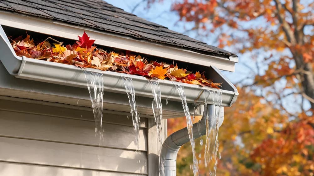
- Maintain your building envelope: Keep roofs, gutters, windows, and foundation walls in good repair to prevent water intrusion during normal storms
- Add sewer backup coverage: Standard homeowner policies in Connecticut exclude sewer backup damage. Add this endorsement -- it is inexpensive relative to the potential damage
- Inspect plumbing regularly: In pre-1960 Hartford homes, have a plumber evaluate supply lines and waste pipes for signs of corrosion and deterioration
- Consider a dehumidifier: Chronic basement dampness in older Hartford homes promotes mold growth. A commercial-grade dehumidifier can maintain safe humidity levels
Advanced DRI provides emergency and planned restoration services across Hartford and the greater Hartford area. Visit our service areas page for details.
Frequently Asked Questions
Is Hartford at risk of a major Connecticut River flood despite the levees?
The Hartford flood control system provides a high level of protection against Connecticut River flooding, designed to handle crests approaching the 1936 record. However, no flood protection system is infallible, and climate change is increasing the probability of precipitation events that could challenge the system's capacity. Additionally, areas outside the levee protection zone, such as portions of the Sheldon-Charter Oak neighborhood, remain directly vulnerable. Flood insurance is recommended for any Hartford property near the river or in mapped flood zones.
Why does my Hartford basement flood even though I am not near the river?
Interior urban flooding in Hartford typically comes from overwhelmed stormwater systems, particularly in areas served by the combined sewer system. The Park River conduit system can also contribute to flooding in North End neighborhoods. Poor lot drainage, failed sump pumps, and deteriorating foundation walls in older buildings compound the problem. Advanced DRI can assess your specific situation and recommend solutions. Contact us through our assessment page.
Does building age affect insurance availability in Hartford?
Building age can affect both the availability and cost of insurance in Hartford. Properties with outdated electrical systems, aging roofing, and old plumbing may face higher premiums or be limited to actual cash value policies. Some insurers require updated systems as a condition of coverage. Investing in key upgrades -- particularly electrical panels, plumbing, and roofing -- can improve both your coverage options and your premium costs while significantly reducing your water damage risk.
Water Damage in Hartford?
Advanced DRI provides 24/7 emergency water damage restoration across Hartford and the greater Hartford metro area. Our teams are experienced with the unique challenges of the city's older building stock.
Categories
Need Restoration Services?
Our team is available 24/7 for emergency response. Call us today for a free phone consultation.


Questions About Restoration?
Our experts are ready to help. Contact us for a free consultation.