Tyler McClelland leads mitigation operations for Advanced DRI across New York's Hudson Valley, directing water, mold, and large-loss response in the field. He holds IICRC Water Restoration Technician (WRT) and Applied Microbial Remediation Technician (AMRT) certifications and a New York State Mold Supervisor certification, and is trained in IRCA hospital safe construction practices recognized by The Joint Commission.
2026 Dauphin County PA flood analysis with Susquehanna River crest data, FEMA declarations from Agnes to Ida, seasonal risk calendars and property protection.
2026 Dauphin County PA Flood History & Outlook
A Data-Driven Analysis by Advanced DRI | Published April 2026
Executive Summary
| Susquehanna River Flood Stage at Harrisburg | 17.0 feet (NWS) |
| Record Crest (Hurricane Agnes, 1972) | 33.27 feet |
| Times Above Flood Stage (2000-2025) | 22 occurrences |
| Properties in FEMA Special Flood Hazard Areas | 12.8% of all parcels |
| County Population (2024 ACS Est.) | 286,401 residents |
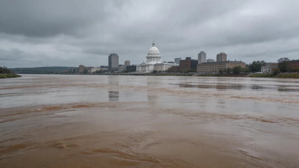
The Susquehanna River defines Dauphin County. As the longest river on the U.S. East Coast, draining over 27,500 square miles across New York, Pennsylvania, and Maryland, the Susquehanna concentrates the rainfall from an enormous watershed directly through the heart of the Harrisburg metropolitan area. At Advanced DRI, we have served Dauphin County property owners through multiple major flood events, and we understand that flood risk here is not theoretical -- it is a documented, recurring reality.
This report compiles historical flood data, FEMA declaration records, and National Weather Service hydrological data to provide Dauphin County property owners with a clear-eyed assessment of their flood risk. The Susquehanna's massive watershed means that heavy rainfall events hundreds of miles upstream can produce devastating floods in communities from Harrisburg to Middletown, Hershey to Hummelstown, and throughout the county's river-adjacent neighborhoods.
Historical Flood Crest Data: Susquehanna River at Harrisburg
The NWS operates a critical river gauge at Harrisburg (USGS 01570500) that has recorded water levels since 1786. The following table documents the most significant flood events in Dauphin County's history, ranked by crest height.
| Rank | Event | Date | Crest (ft) | Above Flood Stage | FEMA Declaration |
|---|---|---|---|---|---|
| 1 | Hurricane Agnes | Jun 23, 1972 | 33.27 ft | +16.27 ft | DR-340 |
| 2 | Tropical Storm Lee | Sep 9, 2011 | 25.37 ft | +8.37 ft | DR-4030 |
| 3 | March 1936 Flood | Mar 18, 1936 | 29.23 ft | +12.23 ft | Pre-FEMA |
| 4 | Hurricane Eloise | Sep 26, 1975 | 23.56 ft | +6.56 ft | DR-487 |
| 5 | Hurricane Ivan | Sep 19, 2004 | 22.64 ft | +5.64 ft | DR-1557 |
| 6 | January 1996 Flood | Jan 20, 1996 | 22.53 ft | +5.53 ft | DR-1093 |
| 7 | Remnants of Hurricane Ida | Sep 2, 2021 | 20.83 ft | +3.83 ft | DR-4618 |
| 8 | Hurricane Irene | Sep 7, 2011 | 20.21 ft | +3.21 ft | DR-4025 |
Flood Crest Visualization: Historical Comparison
Crest Height at Harrisburg Gauge (Flood Stage = 17.0 ft)
Source: National Weather Service Advanced Hydrologic Prediction Service, USGS 01570500
FEMA Disaster Declarations: Dauphin County (2000-2025)
| Declaration # | Event | Date | Type | IA Approved ($) |
|---|---|---|---|---|
| DR-4030 | Tropical Storm Lee / Flooding | Sep 2011 | Tropical Storm | $48.2M |
| DR-4025 | Hurricane Irene | Aug 2011 | Hurricane | $12.7M |
| DR-1557 | Hurricane Ivan | Sep 2004 | Hurricane Remnants | $31.4M |
| DR-4618 | Remnants of Hurricane Ida | Sep 2021 | Tropical Storm/Flooding | $18.9M |
| DR-1649 | Severe Storms and Flooding | Jun 2006 | Riverine Flooding | $9.3M |
| DR-1093 | Winter Storm / Ice Jam Flooding | Jan 1996 | Winter Storm | $22.1M |
Seasonal Flood Risk Calendar
Dauphin County's flood risk does not follow a simple pattern. The Susquehanna's enormous watershed means that different types of events threaten at different times of year, each driven by distinct meteorological mechanisms.
| Season | Flood Mechanism | Flood Risk | Warning Time | Historical Examples |
|---|---|---|---|---|
| Jan - Feb | Ice jam flooding, rain-on-snow, mid-winter thaw | HIGH | 6-24 hours | Jan 1996 (22.53 ft crest) |
| Mar - Apr | Snowmelt + spring rain, saturated soil | HIGH | 24-48 hours | Mar 1936 (29.23 ft crest) |
| May - Jun | Heavy thunderstorm complexes, flash flooding | MOD | 1-6 hours (flash); 24+ hrs (river) | Jun 1972 Agnes (33.27 ft), Jun 2006 |
| Jul - Aug | Tropical moisture, stationary fronts | MOD | 12-36 hours | Multiple minor crests |
| Sep - Oct | Tropical storm remnants, prolonged heavy rain | EXTREME | 24-72 hours | Lee 2011, Ivan 2004, Ida 2021 |
| Nov - Dec | Late-season storms, early freeze/thaw | LOW | 24-48 hours | Minor events |
Flood Zone Distribution: Dauphin County
| FEMA Zone | Description | % of County | Est. Structures | Primary Location |
|---|---|---|---|---|
| AE | 1% annual chance flood (100-year) | 9.4% | 11,280 | Susquehanna corridor, Paxton Creek |
| A | 1% annual chance (approx.) | 3.4% | 4,080 | Small tributaries, rural areas |
| X (Shaded) | 0.2% annual chance (500-year) | 6.8% | 8,160 | Adjacent to AE zones |
| X (Unshaded) | Minimal flood risk | 80.4% | 96,480 | Higher elevation areas |
Beyond the Susquehanna: Secondary Flood Sources
While the Susquehanna River dominates Dauphin County's flood narrative, several secondary waterways create localized flooding risks that affect thousands of properties outside the main river corridor.
Secondary Waterway Flood Risk
| Waterway | Communities Affected | Flood Type | Response Time |
|---|---|---|---|
| Paxton Creek | Harrisburg (east), Swatara Twp. | Flash flood / urban runoff | 1-3 hours |
| Swatara Creek | Hummelstown, Hershey, Middletown | Riverine / prolonged | 6-18 hours |
| Spring Creek | Lower Paxton Twp., Linglestown | Flash flood | 1-4 hours |
| Wiconisco Creek | Upper Dauphin communities | Riverine / flash | 3-8 hours |
| Conewago Creek | Derry Twp., Londonderry Twp. | Riverine | 6-12 hours |
Forward-Looking Risk Assessment: 2026 and Beyond
Several factors inform our outlook for Dauphin County's flood risk in the coming years:
Precipitation Trend Analysis
Average Annual Precipitation at Harrisburg (inches, 5-year averages)
Source: NOAA Climate Normals, NWS Harrisburg Climate Data
Annual precipitation at Harrisburg has increased by approximately 21% since the early 1990s. More critically, the intensity of individual rainfall events has increased, meaning the same annual total is delivered in fewer, heavier downpours that overwhelm drainage infrastructure and drive rivers up faster.
Protecting Your Dauphin County Property
At Advanced DRI, we have responded to every major Susquehanna River flood event in recent memory. Our experience informs the following recommendations:
- Know your elevation relative to flood stage. If the Susquehanna at Harrisburg reaches your flood stage elevation, understand that the river can rise from normal levels to flood stage in 24-36 hours during a major event. Monitor NWS river forecasts at water.weather.gov.
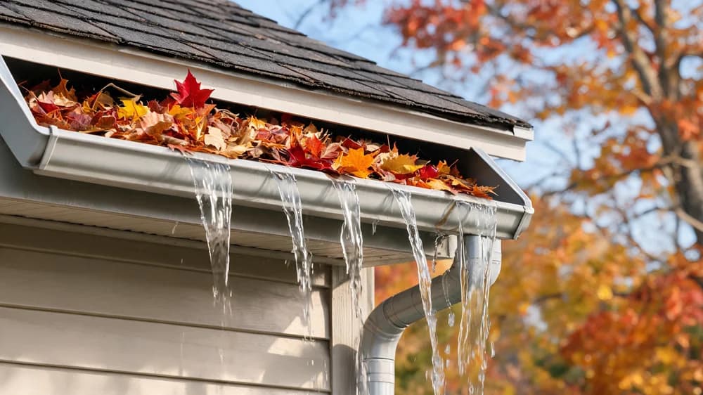
- Waterproof your basement proactively. Our water damage restoration team frequently responds to properties where a modest investment in waterproofing would have prevented tens of thousands of dollars in damage.
- Address mold within 48 hours of any water intrusion. The Harrisburg area's summer humidity means mold colonization can begin within 24-48 hours of a water event. Our mold remediation services can prevent a water damage event from becoming a long-term health hazard.
- Document your property's contents now. Create a detailed photo/video inventory of your belongings before a flood occurs. This single step dramatically speeds insurance claim processing.
- Establish your restoration partnership before you need it. Contact Advanced DRI to register for priority emergency response. Pre-registered clients receive expedited service during widespread events.
Dauphin County Flood Damage Restoration
From the Susquehanna River to Paxton Creek, Advanced DRI provides 24/7 emergency water damage restoration, structural drying, and mold remediation throughout Dauphin County.
Get Emergency Help NowData Sources: FEMA Disaster Declarations Database, NOAA Storm Events Database, National Weather Service Advanced Hydrologic Prediction Service (AHPS), USGS National Water Information System (NWIS), U.S. Census Bureau American Community Survey (2024), FEMA National Flood Hazard Layer (NFHL), National Flood Insurance Program (NFIP) Policy and Claims Data, NOAA Climate Normals. All data accessed January-March 2026.
Categories
Need Restoration Services?
Our team is available 24/7 for emergency response. Call us today for a free phone consultation.


Questions About Restoration?
Our experts are ready to help. Contact us for a free consultation.