Tyler McClelland leads mitigation operations for Advanced DRI across New York's Hudson Valley, directing water, mold, and large-loss response in the field. He holds IICRC Water Restoration Technician (WRT) and Applied Microbial Remediation Technician (AMRT) certifications and a New York State Mold Supervisor certification, and is trained in IRCA hospital safe construction practices recognized by The Joint Commission.
Dutchess County NY property risk assessment for 2026. Hudson River flooding, storm data, and expert restoration guidance from Advanced DRI for Mid-Hudson Valley
Dutchess County NY Property Risk Assessment: 2026 Report
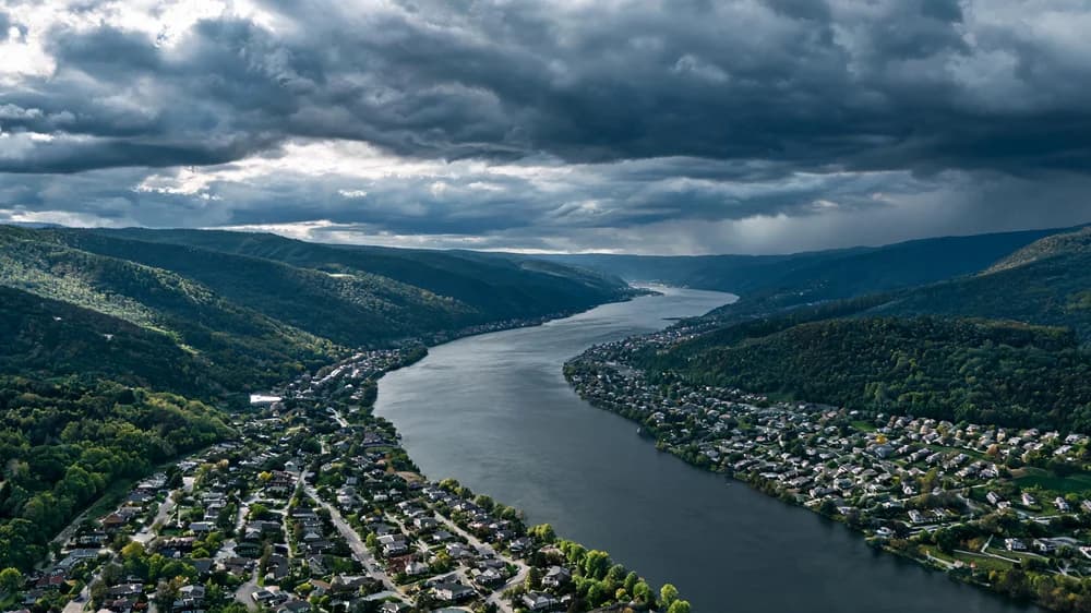
Dutchess County stretches across 825 square miles of the Mid-Hudson Valley, from the Hudson River on its western border to the Taconic Range on the east. Home to approximately 300,000 residents, the county encompasses the cities of Poughkeepsie and Beacon, numerous towns, and a mix of suburban, rural, and increasingly developed communities. At Advanced DRI, we maintain active operations throughout the Mid-Hudson region, and this 2026 risk assessment draws on our direct experience alongside public data to provide property owners with an informed perspective.
Geographic Risk Factors
Dutchess County's flood risk stems from multiple water systems. The Hudson River creates tidal flood exposure for the waterfront communities of Poughkeepsie, Beacon, Wappingers Falls, and Rhinebeck. The Wappinger Creek system, which drains much of the county's interior, has produced repeated flash flooding events in communities along its 60-mile course. Fishkill Creek, the Sprout Creek, and the Ten Mile River contribute additional flood risk in the eastern and southern portions of the county.
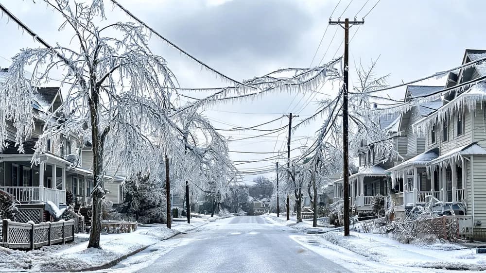
The county's terrain varies dramatically, from sea-level elevations along the Hudson to over 2,300 feet at the highest Taconic ridgelines. This topographic diversity produces varied weather exposure: Hudson Valley communities face fog, ice, and Hudson River flooding, while higher-elevation areas experience more severe winter weather and greater wind exposure.
FEMA Disaster Declarations
| FEMA Declaration | Event | Year | County Impact |
|---|---|---|---|
| DR-4615-NY | Severe Storms & Flooding | 2024 | $8.6M |
| DR-4567-NY | Severe Storms & Flooding | 2023 | $12.3M |
| DR-4480-NY | Remnants of Hurricane Ida | 2021 | $19.7M |
| DR-4322-NY | Winter Storm | 2018 | $5.8M |
| DR-4020-NY | Hurricane Irene | 2011 | $26.4M |
Property Damage Patterns: 2020-2025
| Damage Type | % of Claims | Avg. Cost | Most Affected Areas |
|---|---|---|---|
| Flood & Water Damage | 39% | $17,200 | Poughkeepsie, Wappingers Falls |
| Wind & Tree Damage | 28% | $13,400 | Eastern townships, Beacon |
| Winter Weather Damage | 19% | $9,100 | County-wide |
| Mold Remediation | 14% | $10,600 | Riverfront areas, older homes |
The Wappinger Creek Challenge
Wappinger Creek is the most significant inland flood risk in Dutchess County. The creek's watershed covers approximately 210 square miles, collecting runoff from a large portion of the county's interior before passing through Wappingers Falls and emptying into the Hudson River. The creek's steep upper reaches produce rapid runoff during heavy rainfall, and the narrow channel through Wappingers Falls acts as a bottleneck that can cause dramatic water level rises.
The village of Wappingers Falls has experienced multiple damaging flood events along the creek, including significant damage during Hurricane Irene in 2011 and again during the July 2023 storms. Our team has provided emergency water damage restoration services in this community after several of these events. The pattern of repeated flooding in the same locations underscores the importance of proactive flood protection measures for properties in these corridors.
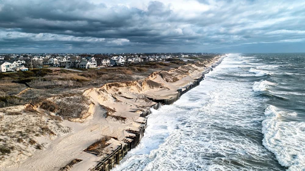
Hudson River Waterfront Risk
The Hudson River waterfront in Poughkeepsie, Beacon, and the riverfront hamlets of Rhinecliff and Tivoli faces tidal flood exposure that is expected to increase with sea level rise. The Hudson River estuary extends well past Dutchess County, and storm surge from coastal events can push water upstream, raising river levels significantly during nor'easters and tropical storms. Properties at low elevations along the waterfront are already experiencing more frequent minor flooding during astronomical high tide events combined with onshore winds.
Recommendations for Dutchess County Property Owners
- Properties along the Wappinger Creek, Fishkill Creek, or Hudson River waterfront should maintain flood insurance coverage
- Have your property's drainage systems, including gutters, downspouts, and yard grading, inspected and maintained annually
- Rural and eastern township property owners should focus on tree management and wind-resistant roofing
- Older homes throughout the county should be inspected for basement water intrusion vulnerability and sump pump adequacy
- Create an emergency plan that includes Advanced DRI's contact information for rapid restoration response
Our team provides comprehensive storm damage restoration, water damage restoration, and mold remediation services throughout Dutchess County. We understand the Mid-Hudson Valley's specific risk profile and respond 24/7. Visit our service areas page for coverage details.
Frequently Asked Questions
Which areas of Dutchess County have the highest flood risk?
The Wappinger Creek corridor through Wappingers Falls, the Fishkill Creek area in Beacon, and the Hudson River waterfront in Poughkeepsie face the highest flood risk. However, flash flooding from intense thunderstorms can affect any community in the county, particularly those in narrow stream valleys in the eastern hills.
How does the Hudson River tide affect flooding in Dutchess County?
The Hudson River is a tidal estuary throughout Dutchess County, with tidal ranges of approximately 3-4 feet at Poughkeepsie. Storm surge from coastal events can add several additional feet to water levels. Combined with upstream rainfall, this tidal influence can produce complex flooding scenarios where waterfront properties face both river flooding and tidal surge simultaneously.
What should I do if my property floods in the Mid-Hudson Valley?
Safety first: avoid contact with floodwater, which may contain sewage or chemicals. Shut off electrical power to affected areas if safe to do so. Document all damage with photos and video. Contact Advanced DRI immediately for professional water extraction and structural drying. Speed is critical: mold can begin growing within 24-48 hours of water exposure, so early intervention dramatically reduces total damage and cost.
Mid-Hudson Valley property owner? We are your restoration partner.
24/7 emergency flood, storm, and water damage response across Dutchess County.
Contact Advanced DRI Today
Data sources: FEMA Disaster Declarations Summary, NFIP claims database, National Weather Service Albany office, USGS Hudson River gauge data, Dutchess County Department of Emergency Response, and Advanced DRI project records. Data current as of Q1 2026.
Categories
Need Restoration Services?
Our team is available 24/7 for emergency response. Call us today for a free phone consultation.

Questions About Restoration?
Our experts are ready to help. Contact us for a free consultation.